Comments
reluctant_presence t1_j7385lf wrote
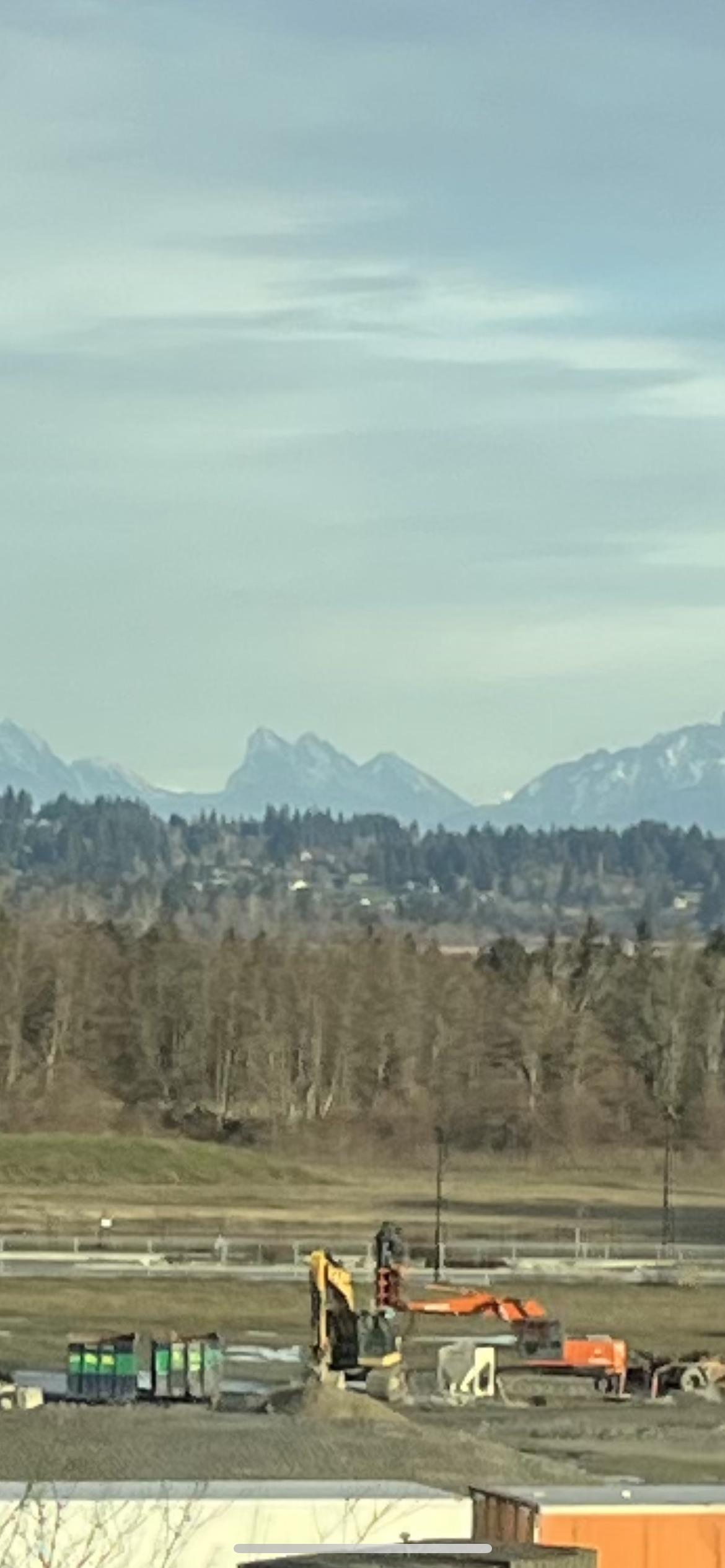
I believe that's Baring Mountain
whidbeysounder t1_j738p2w wrote
I always feel it’s underrated, not the tallest but cool shape
DerekL1963 t1_j73bhhc wrote
Mount Baring.
encee222 t1_j73kotn wrote
Prudential.
aFlippantAmphibian t1_j73o0y0 wrote
Growing up I always thought it was three fingers mountain but Mt Baring is technically correct
Inside_a_whale t1_j73ourc wrote
Great hiking objective. People BASE jump off the taller peak.
WhiteWashTXP t1_j747j6n wrote
> Mt Baring
Yeah, Three Fingers is just a tad further North.
cohete_rojo t1_j74bbph wrote
That's a cool tool!
Moxie_Stardust t1_j74c10j wrote
Just for future reference, PeakFinder is neat for this.
c-g-joy t1_j74hpdb wrote
It is an awesome hike, though quite strenuous with 3,500 feet of gain in 3.5 miles. It’s the 3rd steepest mountain in WA. There are also climbing routes along the north face. Unfortunately the whole area will be closed until at least the beginning of 2024, due to the Bolt Creek fire. While people do base jump from the summit, it is illegal to do so. There have been accidents and several deaths.
ChickenFriedRiceee t1_j74lkon wrote
Side thought, living in the east side of the state. Every time we stopped in north bend. The views were amazing.
aFlippantAmphibian t1_j74n7ic wrote
True but it looks an awful lot like three fingers if you ask me
nolodie t1_j74ruvo wrote
Baring and Grotto Mountains
Iamasansguy t1_j74yp7b wrote
It kinda looks like the Tetons.
meeatch t1_j75018j wrote
3 sisters
deepkick120 t1_j752vt1 wrote
Even better, there’s an app called Peakfinder that gives you a POV wireframe version of this from pretty much anywhere. Best five bucks you’ll spend this month
deepkick120 t1_j752zmb wrote
Where are you finding figures on steepest mountains?
101010-trees t1_j75fjqm wrote
Nice! Thank you internet stranger.
101010-trees t1_j75fkm0 wrote
c-g-joy t1_j75fo48 wrote
I remembered reading it while researching the route before hiking it.
A quick google search pulled up summitpost.org’s list.
leericol t1_j75mfty wrote
I think you're thinking of 3 fingers but this actually isn't it
meeatch t1_j75mkyw wrote
I didn't see the Washington part either, was thinking Alberta. So I was actually wrong twice 😂
washdot t1_j75o0go wrote
It does look like a part of the Tetons from the Tetonia side, about 1/3 of the Tetons. I’ll be driving by there next week.
[deleted] t1_j75yadx wrote
[deleted]
wildskies2525 t1_j75yd0b wrote
The tattoo on my bicep is based on that peak. Really great memories while growing up in the Skykomish River area(near Gold Bar)
bedlog t1_j7793hl wrote
thank you for the link and thanks Everett Herald !!
ZealousidealNet3846 t1_j77en60 wrote
Meadow trail random peak
ZealousidealNet3846 t1_j77eoou wrote
My baring
No-Cheese-Please t1_j77o8io wrote
I didn’t know the actually name of the mountain but is this in the Tatoosh Range?
dokelyok t1_j78cpcc wrote
I did too. Or I guess I always heard it as three sisters? Is that a different mountain altogether? I feel dumb now since I grew up in Snohomish and now live here again and have seen these mountains a million times.
aFlippantAmphibian t1_j78ii03 wrote
Yeah actually I’ve heard it called three sisters too.
[deleted] t1_j78imd4 wrote
tbevans03 t1_j7a579r wrote
Download Peak Finder.
linds_n_pup t1_j7a5cqg wrote
This is so awesome!
TheDreadPirateIcarus t1_j7d7o2o wrote
There are some really good peak identification apps for phones that use the camera. I've been using PeakFinder for years - but it is a paid app. I can't recommend any of the free ones.

[deleted] t1_j736xwd wrote
[removed]